This website is no longer updated and has been replaced with a static copy. The Spatial History Project was active at Stanford University from 2007-2022, engaging in dozens of collaborative projects led by faculty, staff, graduate students, post-docs, visiting scholars and others at Stanford and beyond. More than 150 undergraduate students from more than a dozen disciplines contributed to these projects. In addition to a robust intellectual exchange built through these partnerships, research outputs included major monographs, edited volumes, journal articles, museum exhibitions, digital articles, robust websites, and dozens of lightweight interactive visualizations, mostly developed with Adobe Flash (now defunct). While most of those publications live on in other forms, the content exclusive to this website is preserved in good faith through this static version of the site. Flash-based content is partially available in emulated form using the Ruffle emulator.
WARNING: The Railroaded website is currently offline.

(
launch website)
Books have historically been constrained by the limitations of print medium, and even digital books are usually just electronic replicas of bound volumes.
Stanford University's Spatial History Project has partnered with developers at
Open Sourcery to create an online augmentation to Richard White's latest publication,
Railroaded, that provides an interactive medium for readers to access and explore the collection of over 2,000 footnotes, sources, visualizations, and downloadable data files.
This format holds the potential to give readers a way to access and manipulate the material in the footnotes and to give longer life to the book itself. The dynamic nature of the site will allow White and his team to continue to annotate footnote discourse and develop visualizations as analyses and insights evolve.
In addition to its direct benefit to Railroaded, we believe that this site represents a new genre of hybrid digital publishing and are excited to share this Drupal installation profile with the open source and scholarly communities, for free. By doing so we hope that other authors — of monographs, dissertations, theses, and of purely digital publications — can implement this unique infrastructure of modules to present their own scholarship.
Click here to visit railroaded.stanford.edu.
RELATED VISUALIZATIONS:

Principal Commodities and Eastbound Through Freight
Local and Through Freight by Rail to San Francisco, 1875-1891
Seeing Space in Terms of Track Length and Cost of Shipping
The Rise in the American Railway Union, 1893-1894
Population Density in the United States from 1790 to 2000
Union Pacific Shipping from Nebraska: Forwarded/Received
Exports from Colorado by Station in 1885
California Railroad Commission,
Station Construction Data, 1850-1900

Distribution of Union Pacific Stockholders by City (1869)
Union Pacific Shipping from Nebraska: East/West
Western Railroads and Eastern Capital: Regional Networks on Railroad Boards of Directors, 1872-1894

The Expansion of the Western Railroad
Transcontinental Railroad Development, 1879-1893

Extent of Digitized Railroad
Patterns of Change in Railroad Company Board Members, 1872-1894
Colorado Railroad Accidents, July 1884 - June 1885
Cattle Production in the American West, 1867-1935
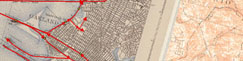
Railroad Repeats: The Alfred A. Hart Photo Project
Per Capita Income in the United States: 1880-1910
The Central Pacific and Transcontinental Eleven Step:
How to Run a Transcontinental Railroad
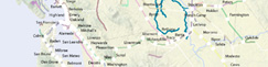
Examples of Digitizing Rail from Historic USGS Quads
RELATED PUBLICATIONS:

A Spatial History Annotated Bibliography

A Data Model for Spatial History

When the Loss of a Finger is Considered a “Minor” Injury

Land Speculation in Fresno County: 1860-1891